AR for Major Infrastructure
3D Walkabout is an Australian based AR studio that designs AR apps for the Major Infrastructure Developments to improve their training and service..

Augmented Reality (AR) for Major Infrastructure Developments
Augmented reality (AR) offers valuable opportunities for government and large organisations in engaging the public and stakeholders while enhancing collaboration with colleagues and contractors during various project phases. AR can be utilised to create interactive experiences and virtual demonstrations, allowing the public to visualise proposed projects and developments. This fosters transparency, facilitates public engagement, and gathers valuable feedback. Internally, AR enables teams to collaborate effectively by overlaying virtual information onto real-world environments. It provides a shared platform for visualising plans, designs, and data, promoting efficient communication and decision-making. Additionally, AR can support on-site inspections and assist in project monitoring, reducing errors and ensuring adherence to specifications.
What are the benefits of AR for Major Infrastructure Projects?
It allows new objects to be positioned accordingly on-site, as employees are aware of where these are supposed to go thanks to seeing them through the AR software beforehand.
It provides a business with more flexibility in their work.
It opens up the possibility for architects, potential purchasers and shareholders to see the property before it is even completed due to AR visualisations.
It is easy to train other employees within the company to use AR.
It uses computers instead of paper, which means fewer errors and less waste for the environment.
When used alongside the metaverse, it allows for easier collaboration between designers and the other departments.
It is easier to spot errors and impracticalities in the building earlier on in the process.
It can be used effectively for infrastructural maintenance, with lower costs. This is due to the team knowing precisely what needs fixing due to the prior synthetic visualisation
It creates a full immersion in the development by bringing it into the real world, hence more engagement from the team.
How is AR is currently used on major infrastructure & developments projects?
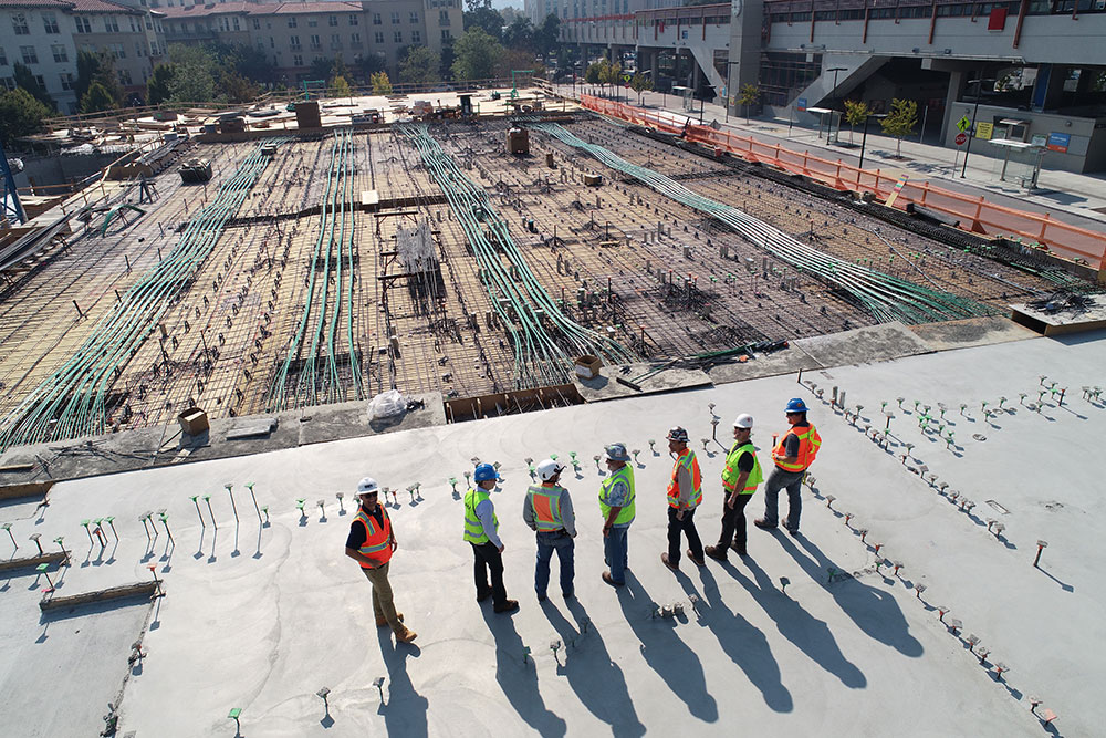
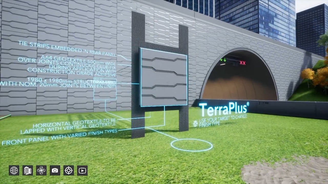
AR is currently bringing projects to life through computer technology. Elements of the infrastructure will be modelled in 3D software and then transferred over to software that allows the AR to take place by using a BIM file from those renders. The 3D models will then be projected onto the surroundings – in this case, the development site – when booting up a gadget or headset, which will allow users to see the exact layout and proposed design of the project. It will be as if you are visiting the building in real life before even the smallest section has been built from physical materials.
The concept is formidably beneficial to all kinds of services and helps us to create ‘smart cities’, spaces that make the most of their surrounding resources and space. This is all thanks to the use of AR and the possibility of being able to visualise the design before it is built and constructed.

Brainstorm your ideas on 1300 00 3392
If you’d like to receive our full ‘AR for Major Infrastructure Information Pack & Price List’ please add your details below.


AR Major Infrastructure Developments Case Studies
No Results Found
The page you requested could not be found. Try refining your search, or use the navigation above to locate the post.
AR Major Infrastructure Developments ; Articles
3D visualisations for major infrastructure projects
There's a lot riding on a major construction project. Not only do designers and contractors need to have confidence in their projects, they also need to encourage public support...
10 incredible major infrastructure visualisations
Cutting-edge visualisations are key to getting your major infrastructure projects off the ground. Immersive technologies such as augmented reality, virtual reality, and CGI have...

Using 3D visualisations to market major infrastructure projects
Marketing a large-scale infrastructure project to financiers, stakeholders and other partners can be tough. One of the issues that project developers have struggled with...
AR Major Infrastructure Developments Videos

Frequently Asked Questions
Can AR be used for on-site construction and maintenance activities?
Absolutely. AR can provide on-site workers with real-time information, such as visualizations of underground utilities, equipment operating instructions, safety precautions, and quality assurance guidelines. By overlaying digital information onto the physical environment, AR enhances efficiency, accuracy, and safety during construction and maintenance tasks in the major infrastructure industry.
How does AR assist in design and planning of infrastructure projects?
AR enables designers and planners to overlay digital models and data onto physical environments, allowing them to assess the visual impact, spatial relationships, and functionality of infrastructure elements. This helps in optimizing designs, evaluating different options, and ensuring that the project aligns with the surrounding environment.
What types of infrastructure projects can benefit from AR?
AR can be applied to a wide range of infrastructure projects, including buildings, bridges, highways, railways, airports, and utility networks. It helps architects, engineers, construction workers, and maintenance crews to better understand project designs, identify potential issues, and efficiently carry out their tasks.
How does AR benefit the major infrastructure industry?
AR provides numerous benefits to the major infrastructure industry. It allows stakeholders to visualize complex infrastructure projects in real-world contexts, aiding in better decision-making and reducing errors. AR also improves collaboration among project teams, enhances safety by providing virtual training and real-time guidance, and streamlines maintenance and repair processes.
What is AR (Augmented Reality) and how is it used in the major infrastructure industry?
Augmented Reality (AR) is a technology that overlays digital information and virtual objects onto the real world. In the major infrastructure industry, AR is used to enhance visualization, improve project planning, facilitate design reviews, and support on-site construction and maintenance activities.