 HOME
HOME 3D RENDERING
 3D SCANNING
 XR DEVELOPMENT
3D Virtual Tours for Residential Building Construction
Capture every stage of a residential build with Matterport 3D tours. From slab and framing through to lock-up, fit-out and handover, 3D Walkabout helps builders and architects create a clear, shareable visual record of site progress, making it easier to communicate with clients, consultants and project teams.

New Homes
Create a digital x-ray before the walls close.
Verify trade work remotely, document mechanicals, and defend against warranty claims for years to come.
Market the Brand
Turn every finished home into a 24/7 virtual tour.
Maintain consistency across your brand with the industry’s gold standard for virtual tours on every listing.

3D Matterport Tours for Residential Building Construction
Matterport 3D tours give residential builders and architects a clear, visual record of a home as it moves through each stage of construction. From slab and framing through to services, plasterboard, fit-out and final handover, each scan creates a fully navigable digital twin that can be reviewed, shared and referenced at any time. For builders, this means better progress documentation, fewer unnecessary site visits, clearer communication with clients and consultants, and a reliable visual record if questions or disputes arise later. For architects, it provides a practical way to check design intent against site progress, review details remotely, and keep clients aligned throughout the build.
By capturing key milestones before work is covered up, such as wall cavities, plumbing, electrical, structural elements and finishes, Matterport tours help residential construction teams reduce confusion, speed up decision-making and create a complete digital record of the project from start to finish.

We’re in your backyard!
We operate nationwide across Australia with the biggest network of operators in the country.
Just give us a call on 1300 00 3392 or contact us here for an instant quote and to get booked in.

3D VIRTUAL TOURS <500 SQM $500 NATIONWIDE
BOOK NOWBenefits of using 3D virtual tours for Residential Building Construction
Document every stage of the build. Capture a clear visual record of the project from slab and framing through to services, fit-out, completion and handover.
Reduce unnecessary site visits. Allow clients, architects, consultants and project managers to review progress remotely without needing to physically attend site every time.
Improve communication with clients. Give homeowners and stakeholders a simple way to understand what has been completed, what is still in progress, and how the build is taking shape.
Capture details before they are covered up. Scan wall cavities, plumbing, electrical, structural elements and other hidden works before plasterboard, linings or finishes are installed.
Create a reliable progress record. Maintain a time-stamped digital twin that can be referenced later if questions, defects, variations or disputes arise.
Support architects with remote site review. Help architects check construction progress against the design intent, review details remotely and identify issues earlier in the process.
Speed up decision-making. Use a shared 3D record to clarify site conditions, reduce back-and-forth, and help clients, builders and consultants make faster decisions.
Improve handover documentation. Provide a fully navigable visual record of the completed home, including rooms, finishes, layouts and key construction details.
Help manage multiple residential projects. Give building companies a practical way to monitor several sites without relying solely on photos, phone calls or repeated site inspections.
Strengthen client confidence. Show clients that progress is being professionally documented, giving them greater transparency and confidence throughout the build.

Get a pre-drywall permanent record.
Create a permanent, pre-drywall 3D record of every mechanical, wire, and duct. Cut warranty disputes and reduce insurance risk with irrefutable proof of what’s behind the wall.

Unlock instant remote job inspections.
Enable your team to virtually inspect 15 job sites before lunch. Verify progress and check trade quality remotely, so you can approve bank draws without leaving the truck.

Put your social content on autopilot.
Our AI automatically transforms your 3D scans into social-ready auto-guided video tours, keeping your Instagram feed active and your marketing budget intact.

Elevate your standard, everywhere.
Use 3D tours to showcase every model, finish package, and shared space, capturing the full range of your offering and delivering a consistently premium experience for every buyer.
How are Matterport 3D tours currently being used by Architects & Builders in Australia?
Matterport 3D tours are increasingly being used by residential builders and architects to document construction progress, improve communication, and create a reliable visual record of each stage of a home build.
Rather than relying only on site photos, email updates or physical inspections, a Matterport scan allows project teams, clients and consultants to virtually walk through the property at key milestones. This is especially useful during slab, frame, rough-in, lock-up, fit-out and final handover stages.
For builders, Matterport provides a practical way to show clients exactly what has been completed, reduce unnecessary site visits, and maintain a clear record of work before it is covered up. Wall cavities, plumbing, electrical services, structural details and finishes can all be captured and revisited later if questions arise.
For architects and designers, Matterport tours make it easier to review construction progress remotely, check that the build is aligning with the design intent, and identify issues before they become costly variations or delays.
At completion, the final Matterport tour can also be used as part of the handover process, giving the homeowner and project team a navigable digital record of the finished property, including layouts, room details and completed finishes.
Your projects, mastered with 3D.

High-Fidelity Digital Twins
Accurate enough to verify construction quality behind the walls, and detailed enough to captivate buyers on your website.

AI-Driven Automation
Auto-generate guided tours, social-ready videos, and shareable floorplans ready for marketing.

Cloud-Based Collaboration
Connect your whole team. Tag trade issues during the build and share immersive virtual tours with buyers at launch — all in one place.
Book Your Matterport 3D Scan
Get pricing, timelines, and expert advice for your Matterport project.
From immersive 3D virtual tours to fully detailed digital twins, we deliver fast, accurate Matterport scans using the latest Pro3 technology. Fill out the form to get our Matterport pricing guide and see exactly how your project will work — from capture through to final delivery. Or call us on 1300 00 3392 to get started today.
Our Recent Projects
-
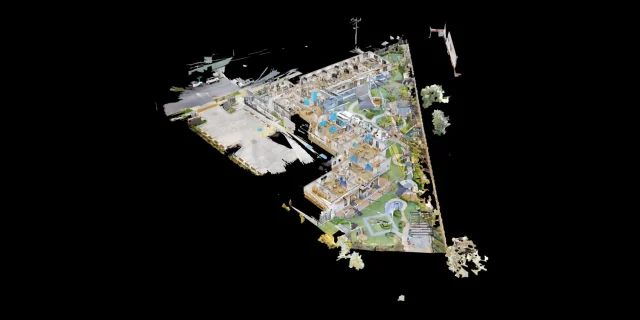 Childcare 3D Virtual Tour | 21 McIntyre St Matterport See how a full 2400 sqm childcare site was captured with a high-quality 3D virtual tour
 -
 AMS Constructions TerryWhite Chemmart Beenleigh 3D Tour Discover how AMS Constructions delivered fast-turnaround Matterport 3D scans for TerryWhite Chemmart Beenleigh, managing multiple sites, tight schedules,
 -
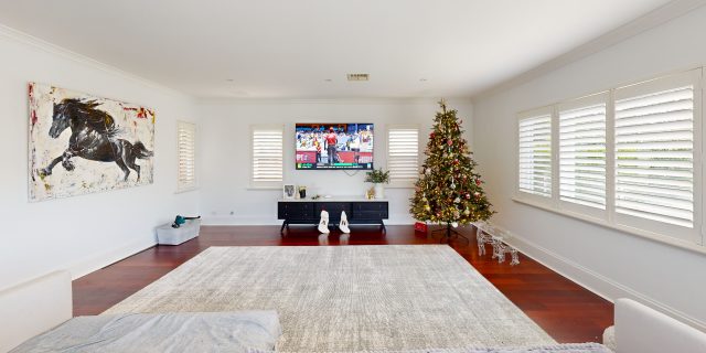 Campbell Architecture | Matterport Scan of Claremont Property 3D Walkabout captured a Matterport scan of a Claremont home, giving Campbell Architecture a digital twin they
 -
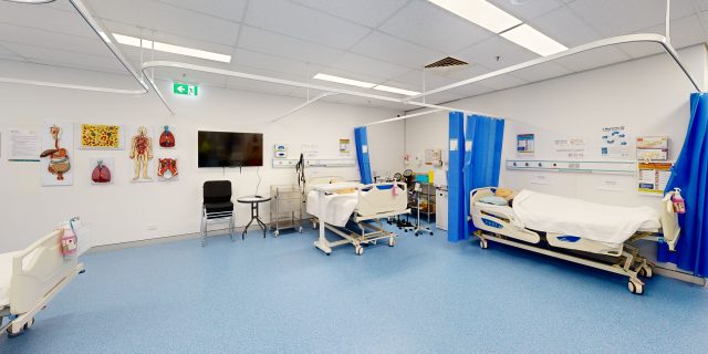 Health Careers International | Virtual Tour of IHNA Brisbane Campus 3D Walkabout captured IHNA’s Brisbane campus using Matterport, delivering a clean, self-guided virtual tour with
 -
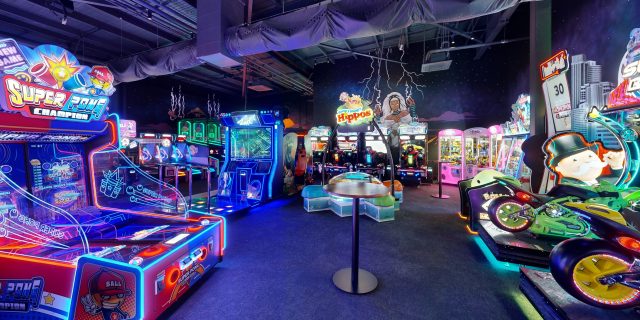 Varsity Cannington Virtual Tour | Matterport for Hospitality Venues We delivered a detailed Matterport tour of Signature Hospitality’s Varsity Cannington, showcasing key feature areas and
 -
 TSA Riley | Matterport Virtual Tour of Aged Care Facilities 3D Walkabout captured fully operational aged care buildings for TSA Riley using Matterport, creating a
Frequently Asked Questions
What is an as-built survey and how does 3D laser scanning help?
An as-built survey documents the exact dimensions and layout of an existing building or structure. Using 3D laser scanning, millions of measurement points are captured to create an accurate digital representation of the space. This data can then be used to produce BIM models, CAD drawings, floor plans and point cloud datasets, helping architects and engineers design renovations or new works with confidence.
What is the difference between LiDAR scanning and photogrammetry?
LiDAR scanning uses laser sensors to measure distances and capture millions of highly accurate spatial points, creating a precise 3D point cloud of a building or environment. Photogrammetry uses overlapping photographs to reconstruct 3D models, which can be useful for visualisation but is generally less accurate for measurement. For architectural surveys, construction planning and Scan-to-BIM projects, LiDAR scanning is typically preferred because it delivers higher accuracy and more reliable spatial data.
How much does a 3D laser scanning project cost?
The cost of a 3D scanning project depends on several factors including site size, building complexity, deliverables required and the type of scanner used. Smaller projects may be completed for a few thousand dollars, while larger commercial or infrastructure projects require more extensive capture and modelling work. A tailored quote is typically provided after reviewing the project scope.
Can 3D scanning be used for renovations and refurbishment projects?
Yes. Laser scanning is widely used to create accurate existing-conditions documentation before renovation or refurbishment work begins. By capturing the building geometry in detail, designers and contractors can reduce measurement errors, improve coordination and avoid costly rework during construction.
Do you provide 3D laser scanning services across Australia?
Yes. 3D Walkabout operates scanning teams across major Australian cities including Sydney, Melbourne, Brisbane, Perth and Adelaide, and can deploy to regional and remote locations nationwide. Our team regularly works on projects ranging from single buildings to large industrial and infrastructure sites.
What is Scan-to-BIM modelling?
Scan-to-BIM is the process of converting laser scanning data into a Building Information Model (BIM). Using the captured point cloud, specialists create detailed digital models of the building in software such as Autodesk Revit. These models can include architectural, structural and MEP elements depending on the required Level of Development (LOD).
What is a point cloud and how is it used?
A point cloud is a digital dataset made up of millions of measured points that represent the exact geometry of a building or environment. These datasets allow architects, engineers and contractors to analyse existing conditions and create accurate models. Point clouds are commonly used as the foundation for Scan-to-BIM and as-built documentation.
What deliverables do you receive after a 3D scanning project?
Typical deliverables include registered 3D point cloud datasets, BIM models, CAD drawings, panoramic imagery and digital walkthroughs. Files can be provided in formats such as RCS/RCP, E57, Revit models and DWG drawings so they integrate easily into common design and construction software.
How long does a 3D laser scanning project take?
The time required depends on the size and complexity of the site. Smaller buildings can often be captured in a few hours, while larger commercial or industrial sites may take one or more days of scanning. Once the data is captured, processing and deliverables such as point clouds or BIM models are typically delivered within several business days.
What types of buildings and spaces can be scanned?
3D laser scanning can be used on almost any built environment including residential buildings, commercial offices, retail centres, industrial warehouses, hospitals, schools, infrastructure sites and heritage buildings. Large facilities such as campuses, factories and shopping centres can also be scanned using mobile LiDAR technology.
How accurate is LiDAR scanning for construction projects?
Modern terrestrial laser scanners can capture measurements with millimetre-level accuracy, depending on the equipment used. Survey-grade scanners such as the Leica RTC360 can achieve accuracy of around ±1.9 mm at 10 metres. This level of precision makes laser scanning suitable for architectural surveys, construction verification, and detailed BIM modelling.
What is 3D laser scanning for buildings?
3D laser scanning is a reality capture technology that uses LiDAR sensors to measure buildings and environments with millions of precise data points. The result is a highly detailed 3D point cloud that represents the exact geometry of the space. This data can then be used for Scan-to-BIM modelling, CAD drawings, digital twins, and building documentation.