 HOME
HOME 3D RENDERING
 3D SCANNING
 XR DEVELOPMENT
3D VIRTUAL TOURS FOR ARCHITECTURE, ENGINEERING & CONSTRUCTION
A 3D virtual tour means your project sites, structures and built environments are fully documented and accessible any time, giving your architects, engineers, contractors and stakeholders a complete visual record without the need for repeated on-site visits.
Capture, document, and collaborate with unmatched 3D visual clarity.

Design
Capture accurate as-built conditions and property data for:
- As-built documentation
- Condition assessments
- Design/risk assessments
- Concept/detailed design
- Construction planning
- Scan-to-CAD / BIM file
- Estimation

Construction
Keep projects on schedule and proactively resolve issues with:
-
Progress monitoring
-
QA/QC
-
Issue & RFI coordination
-
Work package sign off
-
Milestone documentation
-
Safety trainin

Commissioning
Provide reliable digital assets that support ongoing operations, including:
-
Closeout documentation
-
FM database
-
Spec/warranty documentation
-
Training/onboarding asset
-
Building promotion asset
Explore two stages of the same build.
3D Matterport for Architecture, Engineering & Construction
3D Walkabout helps architects, engineers and construction teams document project sites, structures and built environments with immersive Matterport 3D virtual tours. With a digital twin, AEC professionals can capture site conditions, spatial layouts and construction progress in a way that static photos and written reports simply cannot match, reducing unnecessary site visits, improving team collaboration and maintaining an accurate visual record at every stage of a project.
In practice, that means an architect can walk through a structure remotely before coordinating design reviews. An engineer can inspect a site without the travel costs. A project manager can measure clearances, check construction progress and confirm site conditions from their desk. For AEC firms managing multiple projects and sites, one scan creates a permanent digital record that works across internal teams, contractors, compliance documentation and stakeholder reporting.
Share as-built context clearly.
Add and manage tagged details easier than ever before.

Field Tags and Contextual Notes
Add tags while scanning to capture important details, notes and contextual information as you go, even when working offline in remote or low-connectivity environments.

Tags Import and Export Plug In
Effortlessly manage documentation by importing and exporting tagged data to new projects, existing workflows or between spaces across your entire portfolio.

Minimise site visits.
Whether conducting safety training or quality inspections, 3D Walkabout scans give AEC project stakeholders secure, around-the-clock access to any job site at every stage of the project.
Streamline as-built model creation.
Remove the need for manual measuring and speed up as-built model creation using 3D Walkabout scans to generate high-density point clouds and LOD 200 BIM files. Export files including E57, XYZ, OBJ, RVT, IFC and DWG as a baseline to kickstart your model development process.

Collaborate in context.
Digitise your QA/QC process and eliminate miscommunication using 3D Walkabout digital twins. Identify architectural and construction issues before they impact project budgets and schedules.
We’re in your backyard!
We operate nationwide across Australia with the biggest network of operators in the country.
Just give us a call on 1300 00 3392 or contact us here for an instant quote and to get booked in.

3D VIRTUAL TOURS <500 SQM $500 NATIONWIDE
BOOK NOWBenefits of using Matterport 3D virtual tours for Architecture, Engineering & Construction
Document every project site, structure and built environment in full 3D. Give your architects, engineers and project teams an accurate, fully navigable digital record of every site across your portfolio without repeated on-site visits.
Access any project or site, any time, from anywhere. Your Matterport digital twin works around the clock, keeping architects, engineers, contractors and project stakeholders connected and informed.
Reduce costly and time-consuming physical site visits across your projects. Cut the overhead of coordinating access to construction sites, existing structures and built environments without losing visibility of site conditions and progress.
Put your critical design details and construction progress front and centre. Highlight layouts, structural elements and site configurations in full 3D to support design reviews, site meetings and contractor briefings.
Turn every scan into a permanent compliance and project record. Generate floor plans, spatial data and visual records that support audits, regulatory submissions, handovers and as-built documentation.
Stay ahead of AEC firms still relying on outdated site photos and inspection reports. Give your architects, engineers and project teams a faster, more accurate way to capture and share site conditions across every project.
Give every stakeholder a reason to trust your project and site records. When design accuracy, compliance and construction quality are on the line, a Matterport digital twin of every site removes all doubt.
Keep project teams aligned and reduce costly miscommunication before works begin. Digital twins give contractors, engineers and consultants a shared visual reference of every site and structure before they arrive.
Speed up approvals for teams waiting on accurate site and design information. Answer every layout and spatial question instantly without coordinating a physical visit to the project site.
Turn every scan into a long-term project and asset management tool. AEC teams with Matterport digital twins make faster decisions and spend less time conducting repeated on-site visits
How Matterport 3D virtual tours are helping AEC teams improve accuracy, reduce site visits and deliver projects smarter?
A Matterport 3D virtual tour gives architecture, engineering and construction teams something static photos and written site reports never can, the ability to actually walk through a project site, structure or built environment without coordinating a physical visit. AEC teams that integrate 3D digital twins into their workflows see architects spending less time travelling between sites, contractors arriving better prepared, and design and construction decisions made faster with a shared visual reference everyone can navigate.
For project managers overseeing multiple sites and developments, the value goes well beyond documentation. 3D digital twins give your team a single source of truth for every project and structure, supporting design reviews, construction progress tracking, compliance checks and contractor briefings without anyone needing to travel to site. From a single building project to a multi-site construction portfolio, 3D Walkabout gives your entire project pipeline a consistent, accurate digital record that works harder than any site report.
Integrate with tools you already use.
Connect 3D Walkabout digital twins with your existing AEC project management software to enable seamless collaboration across stakeholders, streamline workflows, eliminate information gaps and communicate site issues with full 3D visual clarity.


How leading AEC firms are raising the bar on efficiency.
Accurate, up-to-date building information is essential for architects, engineers and construction teams to effectively manage any project. Learn how forward-thinking AEC firms use 3D Walkabout digital twins to minimise site visits, reduce costs and set a new standard for project efficiency.
Book Your Matterport 3D Scan
Get pricing, timelines, and expert advice for your Matterport project.
From immersive 3D virtual tours to fully detailed digital twins, we deliver fast, accurate Matterport scans using the latest Pro3 technology. Fill out the form to get our Matterport pricing guide and see exactly how your project will work — from capture through to final delivery. Or call us on 1300 00 3392 to get started today.
The right tools for the job.

Scan with ease.
3D Walkabout works with a range of Matterport cameras to suit any project site, building type or capture requirement.

Keep your data secure.
Apply varying levels of user permissions to keep your project data private, protected and accessible only to the right people.

Collaborate efficiently.
Access intuitive tools to collaborate, plan and share with your team, consultants, contractors and project stakeholders.

System integrations.
Bring visual clarity to your AEC workflows by integrating directly with Autodesk, Procore and other leading platforms.
Our Recent Projects
-
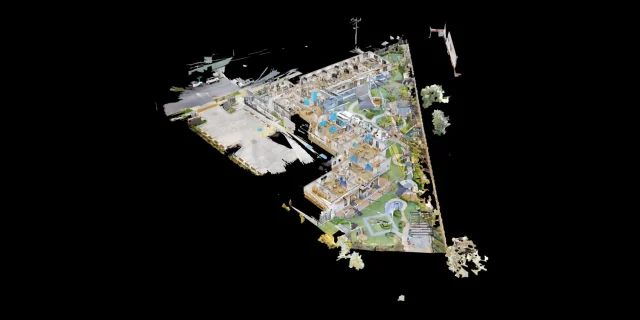 Childcare 3D Virtual Tour | 21 McIntyre St Matterport See how a full 2400 sqm childcare site was captured with a high-quality 3D virtual tour
 -
 AMS Constructions TerryWhite Chemmart Beenleigh 3D Tour Discover how AMS Constructions delivered fast-turnaround Matterport 3D scans for TerryWhite Chemmart Beenleigh, managing multiple sites, tight schedules,
 -
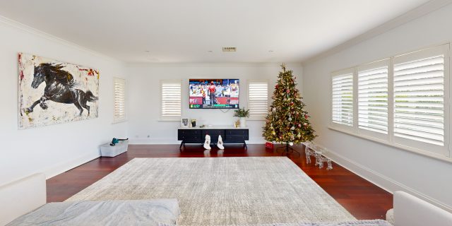 Campbell Architecture | Matterport Scan of Claremont Property 3D Walkabout captured a Matterport scan of a Claremont home, giving Campbell Architecture a digital twin they
 -
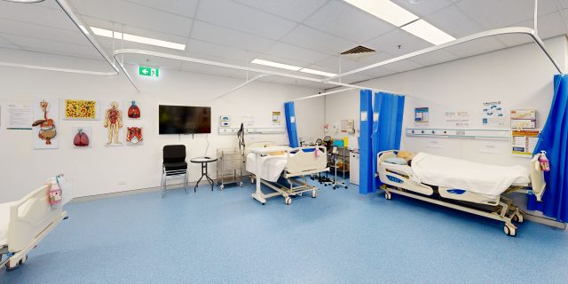 Health Careers International | Virtual Tour of IHNA Brisbane Campus 3D Walkabout captured IHNA’s Brisbane campus using Matterport, delivering a clean, self-guided virtual tour with
 -
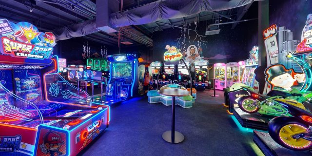 Varsity Cannington Virtual Tour | Matterport for Hospitality Venues We delivered a detailed Matterport tour of Signature Hospitality’s Varsity Cannington, showcasing key feature areas and
 -
 TSA Riley | Matterport Virtual Tour of Aged Care Facilities 3D Walkabout captured fully operational aged care buildings for TSA Riley using Matterport, creating a
Frequently Asked Questions
What reality capture assets can be exported from a Matterport AEC scan?
Available exports include OBJ files, colorised point clouds, reflected ceiling plans, high-resolution 2D floor plans, E57 files, BIM outputs in RVT and IFC formats, and CAD formats including DWG and XYZ, feeding directly into Revit, AutoCAD, ReCap and other BIM and CAD applications.
Does Matterport integrate with Autodesk Construction Cloud or Procore for RFIs?
Yes. Matterport integrates with both Autodesk Construction Cloud and Procore, allowing teams to place RFI pins and issue markers at exact locations within the digital twin so stakeholders can view and resolve issues with full visual context.
How does Matterport handle exterior scanning, long sightlines and bright conditions?
The Matterport Pro3 camera supports both interior and exterior capture with extended range and high accuracy, making it suitable for large areas and long sightlines. Specific environmental conditions such as extreme lighting should be assessed during project planning.
What point cloud density can be expected from a Matterport Pro3 capture?
The Pro3 offers three density options: Standard captures 800,000 depth points in under 20 seconds, Medium captures 1.5 million in under 45 seconds, and High captures 5 million depth points per scan in approximately two minutes.
How accurate are Matterport scan-to-BIM models for architecture and engineering projects?
LiDAR-enabled Matterport scans meet LOD 200 specifications for structural and architectural elements, providing a dependable baseline for as-built modelling and reducing the need for manual survey work during model creation.
Is Matterport suitable for fabrication-level tolerances or do I still need a laser scanner?
Matterport is well suited for layout verification, as-builts, coordination and QA/QC. For fabrication-level or survey-grade tolerances requiring sub-millimetre precision, a terrestrial laser scanner may still be required alongside Matterport capture.
What is the typical turnaround time for E57 exports or BIM deliverables after scanning?
Professional scanning services typically deliver initial scans within 48 hours of capture. Turnaround times for E57, MatterPak and BIM exports vary by project size and selected deliverables, so specific timing should be confirmed based on your project scope.
What ROI and time savings can AEC teams realistically expect from Matterport scanning?
AEC teams report up to 75% reductions in in-person site visits, approximately 70% reductions in survey time, faster documentation delivery, reduced travel and labour costs, and measurable time savings across inspections, coordination and BIM baseline creation.