HIGH ACCURACY SCAN TO CAD SERVICES
Australia-wide Scan-to-CAD services delivering precise, survey-grade drawings from high-definition 3D laser scanning. We convert point cloud data into accurate CAD documentation for design, construction, and asset management across complex commercial and infrastructure projects.

Scan to CAD Services Australia-Wide
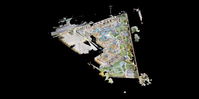
Our Scan-to-CAD services deliver high-accuracy, survey-grade CAD drawings derived from advanced 3D laser scanning. We capture detailed point cloud data across complex environments and convert it into precise, reliable CAD documentation for design, construction, and asset management. From commercial buildings and large-scale infrastructure to industrial facilities and refurbishment projects, our workflows provide accurate as-built drawings that support confident decision-making across every stage of a project. By leveraging high-definition laser scanning, we eliminate manual measurement errors and significantly reduce site revisit requirements.
We specialise in point cloud to CAD conversion, producing detailed 2D drawings and 3D CAD models aligned with project specifications and industry standards. Our process includes robust control, registration, and quality assurance to ensure consistent, repeatable accuracy across all deliverables. Whether you require floor plans, elevations, sections, or fully detailed CAD documentation, our team delivers scalable solutions tailored to the complexity, size, and accuracy requirements of your project.

What are the benefits of Matterport Scan to CAD?
Survey-Grade Accuracy: Capture high-density point cloud data using advanced 3D laser scanning, delivering precise CAD drawings that reduce design risk and costly rework.
Reliable As-Built Documentation: Generate accurate floor plans, elevations, and sections aligned to real-world conditions for refurbishment, redevelopment, and asset management.
Improved Design Coordination: Provide dependable base drawings for architects, engineers, and consultants, supporting clash detection and better project outcomes.
Efficient Data Capture: Rapidly scan complex environments and convert point cloud data into CAD deliverables within defined project timelines.
Reduced Site Risk: Minimise return site visits by capturing complete, measurable datasets upfront, ensuring all required information is available.
Structured Scan-to-CAD Workflows: Apply controlled registration, verification, and QA processes to ensure consistent and repeatable accuracy across all deliverables.
Industry-Standard Deliverables: Provide CAD outputs compatible with AutoCAD, Revit, and other leading platforms for seamless integration into design workflows.
Scalable for Large Projects: Adapt to commercial, industrial, and infrastructure projects with varying complexity and levels of detail.
Enhanced Collaboration: Share accurate CAD documentation across project teams, improving communication and reducing ambiguity.
Future-Ready Asset Data: Create a reliable digital record of existing conditions to support ongoing maintenance, upgrades, and long-term asset management.
Nationwide 3D Scanning & Scan to CAD Services
We deliver high-accuracy 3D laser scanning and Scan-to-BIM / CAD services across Australia, supported by a nationwide network of experienced operators. From major metro projects to regional and remote sites, we provide consistent, survey-grade data capture and modelling for commercial, industrial, and infrastructure projects.
Just give us a call on 1300 00 3392 or contact us here for an instant quote and to get booked in.

Scan to BIM pricing available on Request
REQUEST A QUOTEHow Scan to BIM Transforms Your Building Projects
Discover how 3D Walkabout simplifies building surveys with Scan to BIM technology. These short videos explain key features, from precise 3D scanning to seamless BIM integration.
What are the different types of BIM models available?

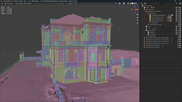
Our Architecture BIM model captures existing interior building conditions, providing precise dimensions, structural elements, and key spatial details essential for accurate design and construction planning.

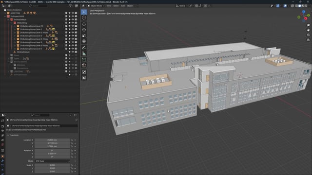
The Architecture, MEP + Furniture model offers a comprehensive solution by combining all architectural, furniture, and MEP components.

The Architecture + Furniture model extends this by including interior architectural details alongside existing furniture, such as tables, seating, cabinets, appliances, kitchen elements, and select wall fixtures.

For more specialised needs, the Architecture + Complex Industrial MEP model is ideal for spaces like mechanical rooms and data centres, featuring generic representations of all non-architectural elements and complex industrial MEP systems.

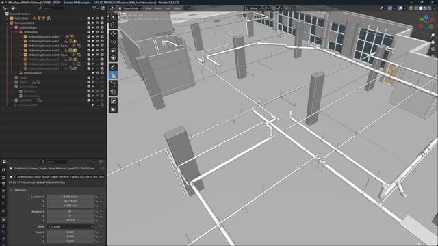
For projects requiring infrastructure details, the Architecture + MEP model adds visible mechanical, electrical, and plumbing systems, covering equipment, piping, plumbing, and electrical outlets.

Start Your 3D Scanning Project
Speak with our team or request our 3D Scanning Information Pack & Price Guide.
Whether you’re planning a reality capture project, need accurate point clouds, BIM modelling, or are exploring digital twin solutions, our team can help. Complete the form below and we’ll send you our 3D Scanning Information Pack & Price Guide, along with details on how our scanning process works and typical project costs. If you’d prefer to talk it through, feel free to call us on 1300 00 3392
Our Recent Projects
-
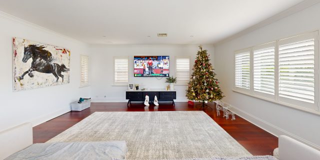
 Childcare 3D Virtual Tour | 21 McIntyre St Matterport See how a full 2400 sqm childcare site was captured with a high-quality 3D virtual tour
 -
 AMS Constructions TerryWhite Chemmart Beenleigh 3D Tour Discover how AMS Constructions delivered fast-turnaround Matterport 3D scans for TerryWhite Chemmart Beenleigh, managing multiple sites, tight schedules,
 -
 Campbell Architecture | Matterport Scan of Claremont Property 3D Walkabout captured a Matterport scan of a Claremont home, giving Campbell Architecture a digital twin they
 -
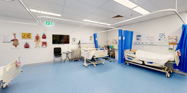 Health Careers International | Virtual Tour of IHNA Brisbane Campus 3D Walkabout captured IHNA’s Brisbane campus using Matterport, delivering a clean, self-guided virtual tour with
 -
 Varsity Cannington Virtual Tour | Matterport for Hospitality Venues We delivered a detailed Matterport tour of Signature Hospitality’s Varsity Cannington, showcasing key feature areas and
 -
 TSA Riley | Matterport Virtual Tour of Aged Care Facilities 3D Walkabout captured fully operational aged care buildings for TSA Riley using Matterport, creating a
Frequently Asked Questions
How is data quality and consistency ensured?
We apply rigorous registration, control point verification, and quality assurance processes throughout the workflow. This ensures all CAD outputs are accurate, consistent, and aligned with real-world site conditions.
Do I need special software to use the CAD files?
No specialised software is required beyond standard industry tools. Our outputs are compatible with AutoCAD, Revit, and other common platforms, ensuring easy access for all project stakeholders.
Can Scan to CAD be used for refurbishment and redevelopment projects?
Absolutely. Scan-to-CAD is ideal for renovations, retrofits, and heritage projects, where accurate existing condition data is critical for design, approvals, and construction planning.
How long does a Scan to CAD project take?
Timeframes depend on project size and complexity, but laser scanning significantly reduces site time compared to traditional methods. CAD deliverables are then produced efficiently from the captured data, often accelerating overall project timelines.
What is the typical Scan to CAD workflow?
Projects typically follow a structured process: site scanning → point cloud registration → QA and verification → CAD modelling → delivery. Each stage is controlled to ensure accuracy, consistency, and alignment with project requirements.
How does Scan to CAD reduce project risk?
By capturing complete and accurate site data upfront, Scan-to-CAD reduces reliance on manual measurement and assumptions. This minimises design errors, rework, and unexpected site issues, helping project teams make informed decisions earlier.
Is Scan to CAD suitable for large or complex projects?
Yes. Our workflows are designed to scale across commercial buildings, industrial facilities, infrastructure, and multi-site portfolios. We handle complex geometries, large datasets, and varying levels of detail to meet project-specific requirements.
What types of drawings can be produced from laser scan data?
We produce a full range of CAD deliverables including floor plans, elevations, sections, reflected ceiling plans, and detailed layouts. Outputs can be tailored to suit project specifications, from basic documentation through to highly detailed technical drawings.
What CAD file formats do you provide?
We deliver industry-standard outputs including DWG, DXF, and Revit-compatible files, along with PDF documentation where required. All deliverables are structured to integrate seamlessly into existing design and BIM workflows.
How accurate are Scan to CAD deliverables?
Our Scan-to-CAD drawings are generated from high-density point cloud data captured using survey-grade 3D laser scanners. This enables millimetre-level accuracy, depending on project requirements, ensuring reliable as-built documentation suitable for design, engineering, and construction.