 HOME
HOME 3D RENDERING
 3D SCANNING
 XR DEVELOPMENT
3D Laser Scanning Services in Perth
High-precision reality capture, LiDAR scanning, and Scan-to-BIM services for architects, engineers, construction teams, and property owners across Perth.
3D Scanning Services Across Perth
Our scanning teams operate across Greater Perth and surrounding regions, delivering fast and reliable on-site data capture for projects of all sizes. We regularly carry out work throughout Perth CBD, East Perth, West Perth, Subiaco, Fremantle, Joondalup, Midland, Cannington and Osborne Park, as well as across the northern and southern suburbs. We can also mobilise to regional locations across Western Australia when required. We support a wide range of projects across metropolitan Perth, including commercial buildings, industrial facilities, infrastructure assets, retail centres and residential developments. Using advanced LiDAR scanning technology, we capture highly accurate spatial data to support design, planning, construction and ongoing asset management workflows.
Our 3D Scanning Equipment
3D Walkabout uses a range of professional 3D scanning technologies to capture buildings, environments, and assets with the appropriate level of accuracy for each project. From rapid mobile LiDAR systems for large spaces to survey-grade laser scanners capable of millimetre precision, our equipment allows us to deliver reliable spatial data for everything from digital walkthroughs to detailed Scan-to-BIM modelling.

Matterport Pro 3
The Matterport Pro3 is a LiDAR-enabled camera designed for rapid capture of interior spaces and immersive digital walkthroughs. It provides measurement accuracy of approximately ±20 mm at 10 metres, making it ideal for interior documentation, property marketing, and quick reality capture of buildings and facilities. The Pro3 is commonly used for digital twins, virtual tours, interior building documentation and preliminary spatial data capture, allowing spaces to be quickly scanned and shared online.

GreenValley O2 Lite
The GreenValley O2 Lite is a mobile LiDAR scanner designed for rapid capture of large environments. Instead of scanning from a tripod, the operator can walk through the space while the system records spatial data using SLAM technology. This makes it ideal for large warehouses, campuses, infrastructure sites and industrial facilities, where speed of capture is more important than survey-grade precision. Mobile LiDAR scanners typically provide centimetre-level accuracy, allowing large areas to be digitised quickly.

Leica BLK360
The Leica BLK360 is a compact terrestrial laser scanner used widely by architects, engineers and survey professionals. It captures high-density LiDAR point clouds with an accuracy of approximately ±4–6 mm at 10 metres, making it suitable for architectural surveys, interior documentation and Scan-to-CAD workflows. Its small size and fast setup make it ideal for interior scanning, refurbishment projects, plant rooms and detailed building documentation.

Leica RTC360
The Leica RTC360 is a high-speed survey-grade laser scanner used for demanding reality capture projects. It delivers millimetre-level accuracy of approximately ±1.9 mm at 10 metres while capturing up to two million measurement points per second. This scanner is commonly used for Scan-to-BIM modelling, construction verification, engineering documentation and large-scale building surveys, where precise spatial data is critical.

Einscan Rigil
The Einscan Rigil is a handheld structured-light 3D scanner designed for capturing smaller objects and equipment with extremely high precision. Handheld scanners of this type can achieve sub-millimetre accuracy, making them ideal for product digitisation, asset capture, mechanical components and reverse engineering applications. Unlike building scanners, this device is used for small-scale objects and detailed assets rather than large spaces.
We offer 3D virtual tours in suburbs throughout Perth.
3D Walkabout delivers professional 3D scanning Perth and laser scanning Perth services, supporting architects, engineers, construction companies and property owners across the metropolitan area. Our scanning teams regularly operate throughout Perth CBD, Subiaco, Fremantle, West Perth, East Perth, Joondalup, Midland, Osborne Park and Cannington, as well as across the northern and southern suburbs.
From commercial offices and residential developments to warehouses, retail centres and major infrastructure projects, our team can rapidly mobilise across Greater Perth to capture highly accurate spatial data using advanced LiDAR technology. Our 3D scanning Perth services enable project teams to generate reliable point clouds, BIM models and CAD documentation, supporting efficient design, planning, refurbishment and construction workflows.
To book a Matterport tour in Perth call us on 1300 00 3392 or contact us here.
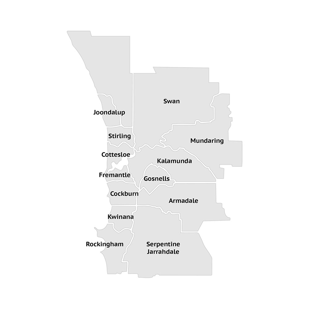
Just some of the many suburbs we service in Perth..
3D Scanning Industries, Locations in Australia & Services
Benefits of 3D Laser Scanning for Perth Projects
Capture highly accurate measurements of buildings and spaces using professional LiDAR scanning Perth services and advanced reality capture technology.
Create dependable digital records of existing conditions for architecture, construction and engineering projects across Perth.
Reduce costly site visits and manual measurements with efficient reality capture Perth, collecting millions of precise data points in a single scan.
Improve design accuracy by providing architects and engineers with detailed point cloud datasets.
Support renovation, refurbishment and redevelopment projects across Perth with accurate as-built documentation.
Streamline Scan-to-BIM workflows with LiDAR scanning Perth, converting laser scan data into precise Revit BIM models.
Enhance coordination between architects, engineers and contractors using shared spatial data and reality capture Perth solutions.
Safely and efficiently capture complex Melbourne buildings, infrastructure and industrial facilities using advanced LiDAR technology.
Create digital twins and immersive virtual walkthroughs, enabling teams to explore sites remotely using advanced reality capture technology.
Document buildings and infrastructure with long-term spatial data to support asset management and future planning across Perth.
How are 3D laser scanning services being used by businesses in Perth?
3D laser scanning is rapidly becoming an essential solution for businesses and organisations across Perth that require accurate digital documentation of buildings, infrastructure and physical environments. Using advanced LiDAR technology, 3D scanning Perth services enable spaces to be captured efficiently and transformed into detailed point clouds, BIM models and CAD drawings that support design, planning and construction workflows.
In the architecture and construction sectors, laser scanning Perth is widely used to capture existing building conditions before renovation, refurbishment or redevelopment projects begin. Architects and engineers rely on accurate spatial data from 3D scanning Perth providers to produce precise designs, reduce repeated site visits and minimise costly measurement errors. Through Scan-to-BIM workflows, point cloud data can be converted into detailed Revit models, improving coordination and efficiency across the project lifecycle.
Commercial property owners and facility managers across Perth are also adopting 3D scanning Perth and laser scanning Perth services to create reliable digital records of buildings and assets. These datasets support more efficient facility management by providing up-to-date building documentation for maintenance, upgrades and long-term asset planning.
Large-scale environments such as warehouses, campuses and infrastructure sites can be captured efficiently using mobile LiDAR systems, while high-precision terrestrial laser scanning Perth solutions are used where survey-grade accuracy is required. This combination of technologies allows projects of all sizes to be documented quickly, safely and with exceptional accuracy.
As Perth continues to grow and evolve, 3D scanning Perth plays a key role in helping project teams capture reliable spatial data, streamline workflows and create accurate digital representations of real-world environments.
Start Your 3D Scanning Project
Speak with our team or request our 3D Scanning Information Pack & Price Guide.
Whether you’re planning a reality capture project, need accurate point clouds, BIM modelling, or are exploring digital twin solutions, our team can help. Complete the form below and we’ll send you our 3D Scanning Information Pack & Price Guide, along with details on how our scanning process works and typical project costs. If you’d prefer to talk it through, feel free to call us on 1300 00 3392
Our Recent Projects
-
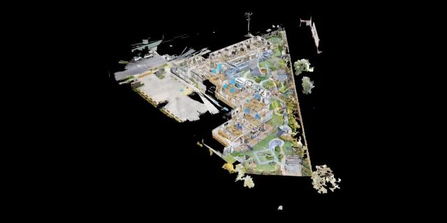 Childcare 3D Virtual Tour | 21 McIntyre St Matterport See how a full 2400 sqm childcare site was captured with a high-quality 3D virtual tour
 -
 AMS Constructions TerryWhite Chemmart Beenleigh 3D Tour Discover how AMS Constructions delivered fast-turnaround Matterport 3D scans for TerryWhite Chemmart Beenleigh, managing multiple sites, tight schedules,
 -
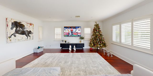 Campbell Architecture | Matterport Scan of Claremont Property 3D Walkabout captured a Matterport scan of a Claremont home, giving Campbell Architecture a digital twin they
 -
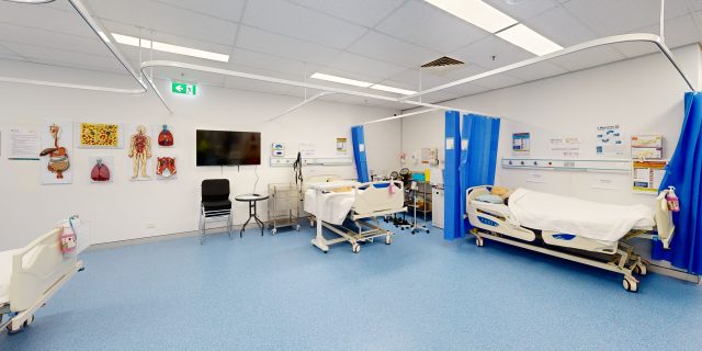 Health Careers International | Virtual Tour of IHNA Brisbane Campus 3D Walkabout captured IHNA’s Brisbane campus using Matterport, delivering a clean, self-guided virtual tour with
 -
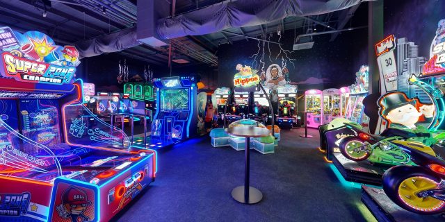 Varsity Cannington Virtual Tour | Matterport for Hospitality Venues We delivered a detailed Matterport tour of Signature Hospitality’s Varsity Cannington, showcasing key feature areas and
 -
 TSA Riley | Matterport Virtual Tour of Aged Care Facilities 3D Walkabout captured fully operational aged care buildings for TSA Riley using Matterport, creating a
Frequently Asked Questions
What is an as-built survey and how does 3D laser scanning help?
An as-built survey documents the exact dimensions and layout of an existing building or structure. Using 3D laser scanning, millions of measurement points are captured to create an accurate digital representation of the space. This data can then be used to produce BIM models, CAD drawings, floor plans and point cloud datasets, helping architects and engineers design renovations or new works with confidence.
What is the difference between LiDAR scanning and photogrammetry?
LiDAR scanning uses laser sensors to measure distances and capture millions of highly accurate spatial points, creating a precise 3D point cloud of a building or environment. Photogrammetry uses overlapping photographs to reconstruct 3D models, which can be useful for visualisation but is generally less accurate for measurement. For architectural surveys, construction planning and Scan-to-BIM projects, LiDAR scanning is typically preferred because it delivers higher accuracy and more reliable spatial data.
How much does a 3D laser scanning project cost?
The cost of a 3D scanning project depends on several factors including site size, building complexity, deliverables required and the type of scanner used. Smaller projects may be completed for a few thousand dollars, while larger commercial or infrastructure projects require more extensive capture and modelling work. A tailored quote is typically provided after reviewing the project scope.
Can 3D scanning be used for renovations and refurbishment projects?
Yes. Laser scanning is widely used to create accurate existing-conditions documentation before renovation or refurbishment work begins. By capturing the building geometry in detail, designers and contractors can reduce measurement errors, improve coordination and avoid costly rework during construction.
Do you provide 3D laser scanning services across Australia?
Yes. 3D Walkabout operates scanning teams across major Australian cities including Sydney, Melbourne, Brisbane, Perth and Adelaide, and can deploy to regional and remote locations nationwide. Our team regularly works on projects ranging from single buildings to large industrial and infrastructure sites.
What is Scan-to-BIM modelling?
Scan-to-BIM is the process of converting laser scanning data into a Building Information Model (BIM). Using the captured point cloud, specialists create detailed digital models of the building in software such as Autodesk Revit. These models can include architectural, structural and MEP elements depending on the required Level of Development (LOD).
What is a point cloud and how is it used?
A point cloud is a digital dataset made up of millions of measured points that represent the exact geometry of a building or environment. These datasets allow architects, engineers and contractors to analyse existing conditions and create accurate models. Point clouds are commonly used as the foundation for Scan-to-BIM and as-built documentation.
What deliverables do you receive after a 3D scanning project?
Typical deliverables include registered 3D point cloud datasets, BIM models, CAD drawings, panoramic imagery and digital walkthroughs. Files can be provided in formats such as RCS/RCP, E57, Revit models and DWG drawings so they integrate easily into common design and construction software.
How long does a 3D laser scanning project take?
The time required depends on the size and complexity of the site. Smaller buildings can often be captured in a few hours, while larger commercial or industrial sites may take one or more days of scanning. Once the data is captured, processing and deliverables such as point clouds or BIM models are typically delivered within several business days.
What types of buildings and spaces can be scanned?
3D laser scanning can be used on almost any built environment including residential buildings, commercial offices, retail centres, industrial warehouses, hospitals, schools, infrastructure sites and heritage buildings. Large facilities such as campuses, factories and shopping centres can also be scanned using mobile LiDAR technology.
How accurate is LiDAR scanning for construction projects?
Modern terrestrial laser scanners can capture measurements with millimetre-level accuracy, depending on the equipment used. Survey-grade scanners such as the Leica RTC360 can achieve accuracy of around ±1.9 mm at 10 metres. This level of precision makes laser scanning suitable for architectural surveys, construction verification, and detailed BIM modelling.
What is 3D laser scanning for buildings?
3D laser scanning is a reality capture technology that uses LiDAR sensors to measure buildings and environments with millions of precise data points. The result is a highly detailed 3D point cloud that represents the exact geometry of the space. This data can then be used for Scan-to-BIM modelling, CAD drawings, digital twins, and building documentation.