 HOME
HOME 3D RENDERING
 3D SCANNING
 XR DEVELOPMENT
CONSTRUCTION LASER SCANNING SERVICES
3D laser scanning for construction projects, providing accurate site data for planning, coordination, and progress tracking. Improve project efficiency and reduce costly errors with reliable reality capture.
Construction Site Reality Capture & LiDAR Scanning
Construction projects rely on accurate, up-to-date site information to maintain progress and avoid costly delays. With multiple trades, evolving site conditions, and tight schedules, even small discrepancies can lead to significant issues if not identified early. Our 3D laser scanning services provide detailed reality capture that reflects the true state of a site at any given time, giving project teams a reliable and current understanding of existing conditions.
Using advanced scanning technology, we capture high-density data quickly and safely, even in active construction environments. This enables teams to identify potential clashes, verify installations, and track progress against design intent with a high level of accuracy. By reducing uncertainty and improving visibility, project stakeholders can make informed decisions faster and with greater confidence.
The data can be used to produce point clouds, models, and comparison reports that support coordination, quality assurance, and project documentation. Whether applied during early planning, throughout construction, or for final verification, it helps minimise rework, improve collaboration between contractors and consultants, and keep projects aligned with timelines and budgets.

What are the benefits of Scan to BIM?
Enhanced Accuracy: Capture precise 3D measurements, reducing errors and ensuring reliable data for design and construction.
Time Efficiency: Expedite the surveying process with rapid 3D scanning, delivering BIM files in days instead of weeks.
Cost Savings: Lower project expenses by decreasing modelling costs by up to 70% compared to conventional methods.
Seamless Integration: Easily import BIM files into Autodesk Revit and other design software, streamlining workflows without manual data translation.
Improved Collaboration: Share detailed 3D models with stakeholders, facilitating better communication and decision-making throughout the project lifecycle.
Comprehensive Documentation: Generate accurate as-built records, aiding in maintenance, renovations, and future expansions.
Reduced Site Visits: Access immersive digital twins remotely, minimising the need for frequent on-site inspections.
Scalability: Adapt to projects of various sizes and complexities with versatile scanning solutions.
Our Process & Deliverables
Data Capture – We scan the site using Matterport Pro3 for fast capture or Trimble X7/Leica scanners for survey-grade accuracy.
Validation – Key dimensions are verified with independent laser measurements to enhance accuracy.
Data Processing – The point cloud is registered, aligned, and cleaned to create a precise dataset.
BIM Modelling – We build a detailed Revit model (LOD 200–500) tailored to project requirements.
Delivery – Final models are supplied in RVT, IFC, or DWG formats for seamless integration into design workflows.
RVT (Revit Model) – A complete Autodesk Revit file for seamless integration into design and BIM workflows.
IFC (Industry Foundation Classes) – Open BIM format enabling collaboration across multiple design and engineering platforms.
DWG (2D CAD Drawings) – Standard AutoCAD files for plans, sections, and elevations, ready for editing and documentation.
E57 (Vendor-Neutral Point Cloud) – A universal format for sharing precise, colourised 3D scan data across software systems.
PDF (2D Plans/Sections/Elevations) – Easy-to-share PDF outputs for quick reference, reviews, and client communication.
Our 3D Scanning Equipment
3D Walkabout uses a range of professional 3D scanning technologies to capture buildings, environments, and assets with the appropriate level of accuracy for each project. From rapid mobile LiDAR systems for large spaces to survey-grade laser scanners capable of millimetre precision, our equipment allows us to deliver reliable spatial data for everything from digital walkthroughs to detailed Scan-to-BIM modelling.

Matterport Pro 3
The Matterport Pro3 is a LiDAR-enabled camera designed for rapid capture of interior spaces and immersive digital walkthroughs. It provides measurement accuracy of approximately ±20 mm at 10 metres, making it ideal for interior documentation, property marketing, and quick reality capture of buildings and facilities. The Pro3 is commonly used for digital twins, virtual tours, interior building documentation and preliminary spatial data capture, allowing spaces to be quickly scanned and shared online.

GreenValley O2 Lite
The GreenValley O2 Lite is a mobile LiDAR scanner designed for rapid capture of large environments. Instead of scanning from a tripod, the operator can walk through the space while the system records spatial data using SLAM technology. This makes it ideal for large warehouses, campuses, infrastructure sites and industrial facilities, where speed of capture is more important than survey-grade precision. Mobile LiDAR scanners typically provide centimetre-level accuracy, allowing large areas to be digitised quickly.

Leica BLK360
The Leica BLK360 is a compact terrestrial laser scanner used widely by architects, engineers and survey professionals. It captures high-density LiDAR point clouds with an accuracy of approximately ±4–6 mm at 10 metres, making it suitable for architectural surveys, interior documentation and Scan-to-CAD workflows. Its small size and fast setup make it ideal for interior scanning, refurbishment projects, plant rooms and detailed building documentation.

Leica RTC360
The Leica RTC360 is a high-speed survey-grade laser scanner used for demanding reality capture projects. It delivers millimetre-level accuracy of approximately ±1.9 mm at 10 metres while capturing up to two million measurement points per second. This scanner is commonly used for Scan-to-BIM modelling, construction verification, engineering documentation and large-scale building surveys, where precise spatial data is critical.

Einscan Rigil
The Einscan Rigil is a handheld structured-light 3D scanner designed for capturing smaller objects and equipment with extremely high precision. Handheld scanners of this type can achieve sub-millimetre accuracy, making them ideal for product digitisation, asset capture, mechanical components and reverse engineering applications. Unlike building scanners, this device is used for small-scale objects and detailed assets rather than large spaces.
We’re in your backyard!
We provide nationwide Scan-to-BIM services across a diverse range of industries
Just give us a call on 1300 00 3392 or contact us here for an instant quote and to get booked in.

Scan to BIM pricing available on Request
REQUEST A QUOTEHow Scan to BIM Transforms Your Building Projects
Discover how 3D Walkabout simplifies building surveys with Scan to BIM technology. These short videos explain key features, from precise 3D scanning to seamless BIM integration.
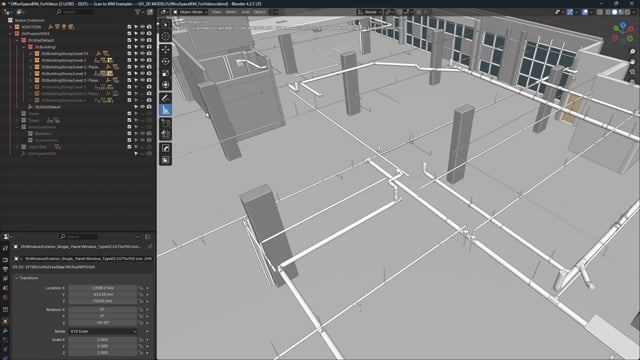
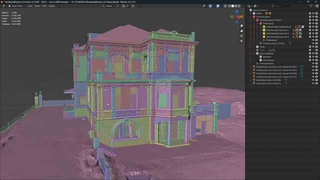
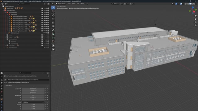
What are the different types of BIM models available?

Our Architecture BIM model captures existing interior building conditions, providing precise dimensions, structural elements, and key spatial details essential for accurate design and construction planning.

The Architecture, MEP + Furniture model offers a comprehensive solution by combining all architectural, furniture, and MEP components.

The Architecture + Furniture model extends this by including interior architectural details alongside existing furniture, such as tables, seating, cabinets, appliances, kitchen elements, and select wall fixtures.

For more specialised needs, the Architecture + Complex Industrial MEP model is ideal for spaces like mechanical rooms and data centres, featuring generic representations of all non-architectural elements and complex industrial MEP systems.

For projects requiring infrastructure details, the Architecture + MEP model adds visible mechanical, electrical, and plumbing systems, covering equipment, piping, plumbing, and electrical outlets.
Start Your 3D Scanning Project
Speak with our team or request our 3D Scanning Information Pack & Price Guide.
Whether you’re planning a reality capture project, need accurate point clouds, BIM modelling, or are exploring digital twin solutions, our team can help. Complete the form below and we’ll send you our 3D Scanning Information Pack & Price Guide, along with details on how our scanning process works and typical project costs. If you’d prefer to talk it through, feel free to call us on 1300 00 3392
Our Recent Projects
-
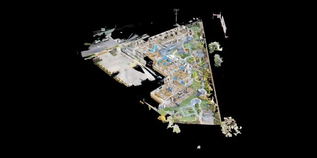 Childcare 3D Virtual Tour | 21 McIntyre St Matterport See how a full 2400 sqm childcare site was captured with a high-quality 3D virtual tour
 -
 AMS Constructions TerryWhite Chemmart Beenleigh 3D Tour Discover how AMS Constructions delivered fast-turnaround Matterport 3D scans for TerryWhite Chemmart Beenleigh, managing multiple sites, tight schedules,
 -
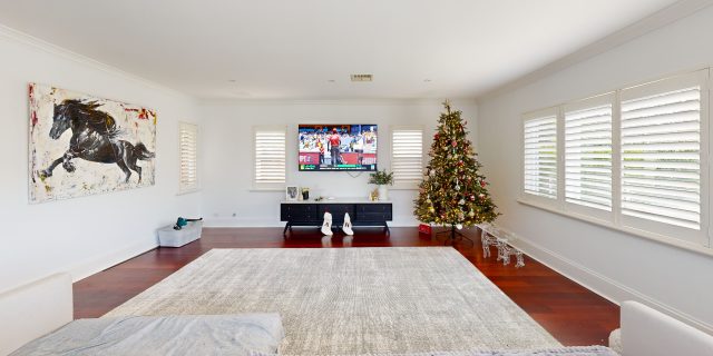 Campbell Architecture | Matterport Scan of Claremont Property 3D Walkabout captured a Matterport scan of a Claremont home, giving Campbell Architecture a digital twin they
 -
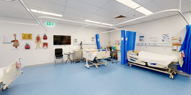 Health Careers International | Virtual Tour of IHNA Brisbane Campus 3D Walkabout captured IHNA’s Brisbane campus using Matterport, delivering a clean, self-guided virtual tour with
 -
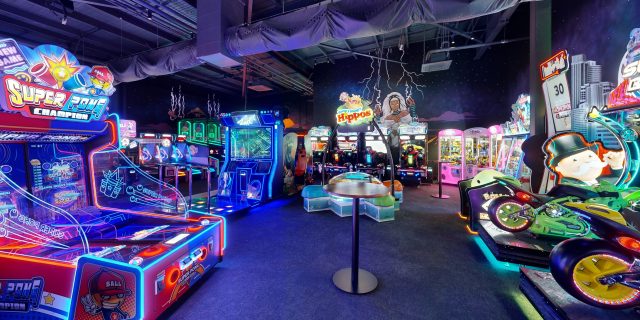 Varsity Cannington Virtual Tour | Matterport for Hospitality Venues We delivered a detailed Matterport tour of Signature Hospitality’s Varsity Cannington, showcasing key feature areas and
 -
 TSA Riley | Matterport Virtual Tour of Aged Care Facilities 3D Walkabout captured fully operational aged care buildings for TSA Riley using Matterport, creating a
Frequently Asked Questions
Can you model heritage or irregular buildings?
Yes. Scan to BIM is well suited to heritage, irregular and complex buildings because laser scanning captures geometry that is difficult to measure manually. The modelling approach should be carefully scoped because highly detailed or non-standard features can require additional modelling time.
How long does a Scan to BIM project take?
The timeframe depends on the size of the site, access conditions, amount of scanning required, model complexity and level of detail. Site scanning may be relatively quick, but modelling time can vary significantly depending on the required deliverables.
What file formats can you provide?
Revit models are commonly provided, along with registered point cloud files and supporting documentation where required. Depending on the scope, we may also provide DWG, IFC, PDF drawings, elevations or sections.
Can the BIM model be used for clash detection?
Yes, a Scan to BIM model can support clash detection and coordination, especially when new design models need to be checked against existing conditions. The usefulness of the model for clash detection depends on the level of detail and which elements have been included.
How accurate is a Scan to BIM model?
The accuracy depends on the scan methodology, registration process, modelling scope and required level of detail. The model is created from measured scan data, but modelling tolerances and element simplification should be agreed as part of the project brief.
Is Scan to BIM suitable for refurbishment projects?
Yes. Scan to BIM is particularly useful for refurbishment, redevelopment, fitout and adaptive reuse projects because it gives the design team an accurate model of the existing building before new design work begins.
Can you model MEP services?
Yes, visible and accessible MEP services can be modelled where required, such as ductwork, pipework, cable trays, plant equipment and major service routes. Concealed services that are hidden behind walls, ceilings or floors cannot be accurately modelled from laser scan data alone unless verified through other information.
What level of detail can you model?
The level of detail depends on the project requirements. We can create simple massing or architectural base models, more detailed architectural and structural models, or models that include selected visible services and complex geometry. The modelling level should be agreed before work begins.
Do we need to provide existing drawings?
Existing drawings are helpful, but they are not always required. If drawings are available, they can assist with understanding the building and setting up the model. However, the laser scan and point cloud provide the measured record of current site conditions.
Can you create a Revit model from a point cloud?
Yes. We can convert registered point cloud data into a Revit model at the agreed level of detail. The model can include architectural, structural and visible services elements depending on the project scope.
What is the difference between a point cloud and a BIM model?
A point cloud is the raw or processed 3D measurement data captured from the laser scanner. It shows the geometry of the site as millions of points. A BIM model is a structured digital model made from building elements. The point cloud is the measured reference, while the BIM model is the usable design and coordination output.
What is Scan to BIM?
Scan to BIM is the process of using 3D laser scanning to capture an existing building, then converting the scan data into a BIM model. The laser scan creates a point cloud of the physical environment, and the BIM modelling stage converts that data into usable model elements such as walls, floors, columns, roofs, openings and other agreed features.